
- Start >
- Rivers >
- Waterlevel >
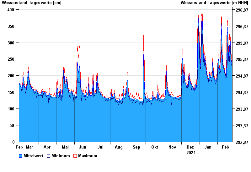
- Oberer Main - Elbe >
- Unterzettlitz >
- Chart of year

Chart of year Unterzettlitz / Roter Main
Waterlevel from 26.02.2021 to 25.02.2022
- 26.01.1995 Wasserstand: 416 cm
- 14.01.2011 Wasserstand: 413 cm
- 23.12.2012 Wasserstand: 410 cm
- 03.01.2003 Wasserstand: 408 cm
- 03.06.2013 Wasserstand: 407 cm
| Date | Mean value [cm] | Maximum [cm] | Minimum [cm] |
|---|---|---|---|
| 25.02.2022 | 235 | 241 | 230 |
| 24.02.2022 | 252 | 273 | 238 |
| 23.02.2022 | 283 | 304 | 273 |
| 22.02.2022 | 324 | 332 | 304 |
| 21.02.2022 | 281 | 324 | 243 |
| 20.02.2022 | 246 | 258 | 241 |
| 19.02.2022 | 279 | 300 | 257 |
© Bayerisches Landesamt für Umwelt 2024