
- Start >
- Rivers >
- Waterlevel >
- Oberer Main - Elbe >
- Unterzettlitz >
- Chart of year

Chart of year Unterzettlitz / Roter Main
Waterlevel from 01.01.2023 to 31.12.2023
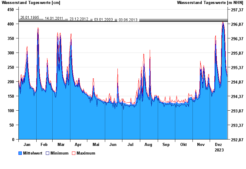
- 26.01.1995 Wasserstand: 416 cm
- 14.01.2011 Wasserstand: 413 cm
- 23.12.2012 Wasserstand: 410 cm
- 03.01.2003 Wasserstand: 408 cm
- 03.06.2013 Wasserstand: 407 cm
| Date | Mean value [cm] | Maximum [cm] | Minimum [cm] |
|---|---|---|---|
| 31.12.2023 | 222 | 231 | 217 |
| 30.12.2023 | 232 | 238 | 226 |
| 29.12.2023 | 247 | 258 | 238 |
| 28.12.2023 | 273 | 288 | 257 |
| 27.12.2023 | 321 | 357 | 288 |
| 26.12.2023 | 376 | 389 | 357 |
| 25.12.2023 | 393 | 398 | 389 |
© Bayerisches Landesamt für Umwelt 2024