
- Start >
- Rivers >
- Waterlevel >
- Oberer Main - Elbe >
- Untersteinach >
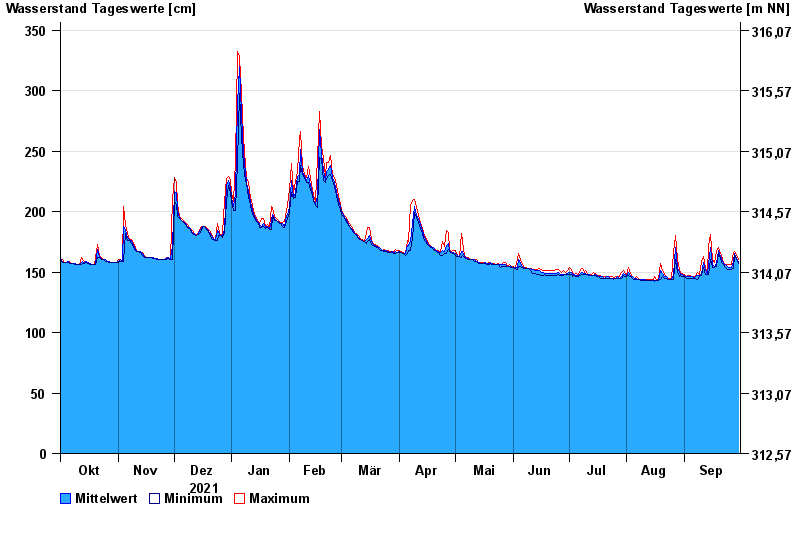
- Chart of year

Chart of year Untersteinach / Schorgast
Waterlevel from 01.10.2021 to 30.09.2022
note
Schlechte Netzanbindung
- 28.05.2006 Wasserstand: 379 cm
- 03.01.2003 Wasserstand: 373 cm
- 01.11.1998 Wasserstand: 367 cm
- 13.02.2005 Wasserstand: 357 cm
- 16.09.1998 Wasserstand: 357 cm
| Date | Mean value [cm] | Maximum [cm] | Minimum [cm] |
|---|---|---|---|
| 30.09.2022 | 159 | 160 | 157 |
| 29.09.2022 | 161 | 164 | 160 |
| 28.09.2022 | 165 | 167 | 164 |
| 27.09.2022 | 159 | 166 | 153 |
| 26.09.2022 | 154 | 156 | 152 |
| 25.09.2022 | 154 | 156 | 152 |
| 24.09.2022 | 155 | 156 | 152 |
© Bayerisches Landesamt für Umwelt 2024