
- Start >
- Rivers >
- Waterlevel >
- Oberer Main - Elbe >
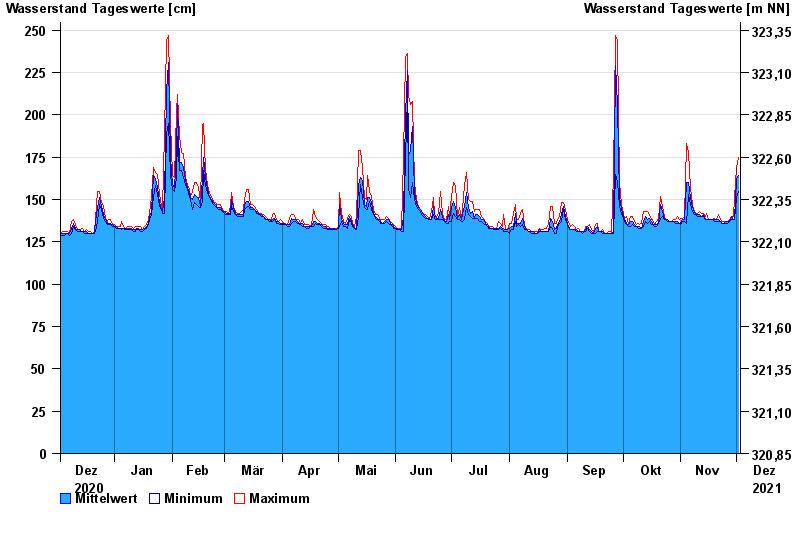
- Trebgast >
- Chart of year

Chart of year Trebgast / Trebgast
Waterlevel from 03.12.2020 to 02.12.2021
- 01.04.1988 Wasserstand: 323 cm
- 08.01.2011 Wasserstand: 317 cm
- 08.06.2002 Wasserstand: 303 cm
- 26.01.1995 Wasserstand: 303 cm
- 01.06.2013 Wasserstand: 295 cm
| Date | Mean value [cm] | Maximum [cm] | Minimum [cm] |
|---|---|---|---|
| 02.12.2021 | 164 | 175 | 155 |
| 01.12.2021 | 162 | 169 | 151 |
| 30.11.2021 | 139 | 151 | 138 |
| 29.11.2021 | 138 | 140 | 138 |
| 28.11.2021 | 140 | 140 | 138 |
| 27.11.2021 | 137 | 138 | 137 |
| 26.11.2021 | 137 | 137 | 136 |
© Bayerisches Landesamt für Umwelt 2024