
- Start >
- Rivers >
- Waterlevel >
- Oberer Main - Elbe >
- Streitmühle >
- Chart of year

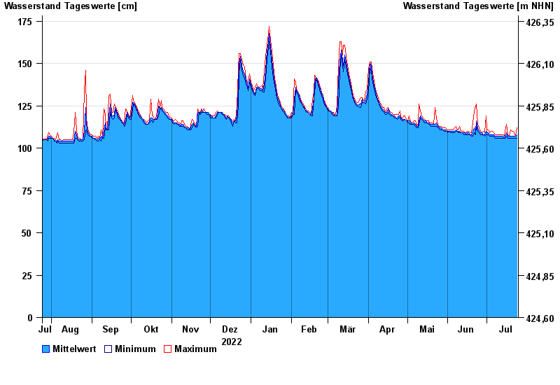
Chart of year Streitmühle / Rodach
Waterlevel from 25.07.2022 to 24.07.2023
- 09.02.1946 Wasserstand: 256 cm
- 28.12.1947 Wasserstand: 248 cm
- 03.01.2003 Wasserstand: 245 cm
- 27.01.2002 Wasserstand: 240 cm
- 06.01.1982 Wasserstand: 240 cm
| Date | Mean value [cm] | Maximum [cm] | Minimum [cm] |
|---|---|---|---|
| 24.07.2023 | 108 | 112 | 106 |
| 23.07.2023 | 107 | 107 | 106 |
| 22.07.2023 | 107 | 109 | 106 |
| 21.07.2023 | 107 | 110 | 106 |
| 20.07.2023 | 107 | 110 | 106 |
| 19.07.2023 | 107 | 111 | 106 |
| 18.07.2023 | 107 | 107 | 106 |
© Bayerisches Landesamt für Umwelt 2024