
- Start >
- Rivers >
- Waterlevel >
- Oberer Main - Elbe >
- Streitmühle >
- Chart of year

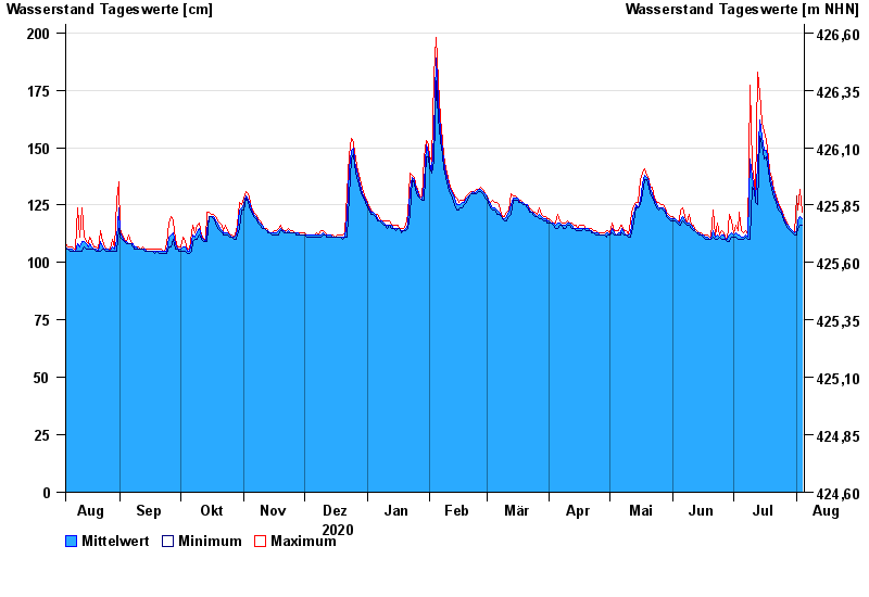
Chart of year Streitmühle / Rodach
Waterlevel from 05.08.2020 to 04.08.2021
- 09.02.1946 Wasserstand: 256 cm
- 28.12.1947 Wasserstand: 248 cm
- 03.01.2003 Wasserstand: 245 cm
- 27.01.2002 Wasserstand: 240 cm
- 06.01.1982 Wasserstand: 240 cm
| Date | Mean value [cm] | Maximum [cm] | Minimum [cm] |
|---|---|---|---|
| 04.08.2021 | 119 | 122 | 116 |
| 03.08.2021 | 120 | 132 | 116 |
| 02.08.2021 | 118 | 123 | 115 |
| 01.08.2021 | 114 | 129 | 112 |
| 31.07.2021 | 113 | 113 | 112 |
| 30.07.2021 | 114 | 114 | 113 |
| 29.07.2021 | 115 | 115 | 114 |
© Bayerisches Landesamt für Umwelt 2024