
- Start >
- Rivers >
- Waterlevel >
- Oberer Main - Elbe >
- Streitmühle >
- Chart of year

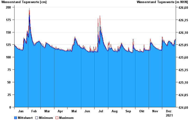
Chart of year Streitmühle / Rodach
Waterlevel from 01.01.2021 to 31.12.2021
- 09.02.1946 Wasserstand: 256 cm
- 28.12.1947 Wasserstand: 248 cm
- 03.01.2003 Wasserstand: 245 cm
- 27.01.2002 Wasserstand: 240 cm
- 06.01.1982 Wasserstand: 240 cm
| Date | Mean value [cm] | Maximum [cm] | Minimum [cm] |
|---|---|---|---|
| 31.12.2021 | 136 | 136 | 135 |
| 30.12.2021 | 133 | 135 | 132 |
| 29.12.2021 | 133 | 134 | 131 |
| 28.12.2021 | 125 | 131 | 122 |
| 27.12.2021 | 123 | 124 | 122 |
| 26.12.2021 | 126 | 126 | 123 |
| 25.12.2021 | 124 | 125 | 123 |
© Bayerisches Landesamt für Umwelt 2024