
- Start >
- Rivers >
- Waterlevel >
- Oberer Main - Elbe >
- Schwürbitz >
- Chart of year

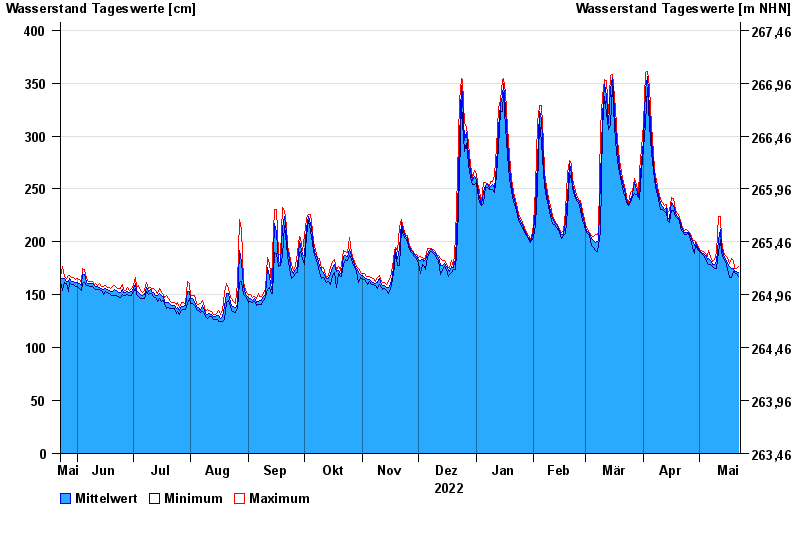
Chart of year Schwürbitz / Main
Waterlevel from 23.05.2022 to 22.05.2023
- 24.12.1967 Wasserstand: 591 cm
- 28.01.2002 Wasserstand: 556 cm
- 03.01.2003 Wasserstand: 553 cm
- 06.01.1982 Wasserstand: 546 cm
- 14.01.2011 Wasserstand: 544 cm
| Date | Mean value [cm] | Maximum [cm] | Minimum [cm] |
|---|---|---|---|
| 22.05.2023 | 171 | 177 | 167 |
| 21.05.2023 | 172 | 175 | 170 |
| 20.05.2023 | 172 | 175 | 171 |
| 19.05.2023 | 175 | 182 | 172 |
| 18.05.2023 | 175 | 184 | 166 |
| 17.05.2023 | 177 | 180 | 166 |
| 16.05.2023 | 180 | 185 | 174 |
© Bayerisches Landesamt für Umwelt 2024