
- Start >
- Rivers >
- Waterlevel >
- Oberer Main - Elbe >
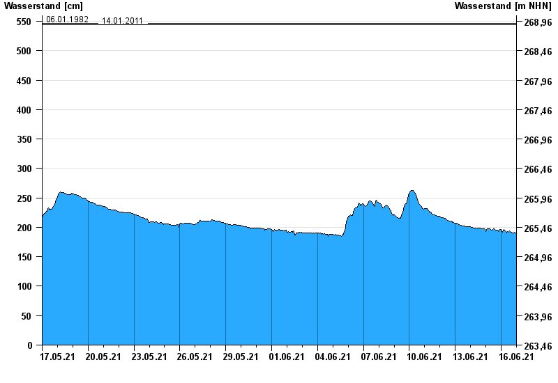
- Schwürbitz >
- Chart of month

Chart of month Schwürbitz / Main
Waterlevel from 17.05.2021 to 16.06.2021
- 24.12.1967 Wasserstand: 591 cm
- 28.01.2002 Wasserstand: 556 cm
- 03.01.2003 Wasserstand: 553 cm
- 06.01.1982 Wasserstand: 546 cm
- 14.01.2011 Wasserstand: 544 cm
| Date | Waterlevel [cm] |
|---|---|
| 17.06.2021 00:45 | 192 |
| 17.06.2021 00:30 | 192 |
| 17.06.2021 00:15 | 192 |
| 17.06.2021 00:00 | 192 |
| 16.06.2021 23:45 | 192 |
| 16.06.2021 23:30 | 191 |
| 16.06.2021 23:15 | 191 |
© Bayerisches Landesamt für Umwelt 2024