
- Start >
- Rivers >
- Waterlevel >
- Oberer Main - Elbe >
- Schlehenmühle >
- Chart of year

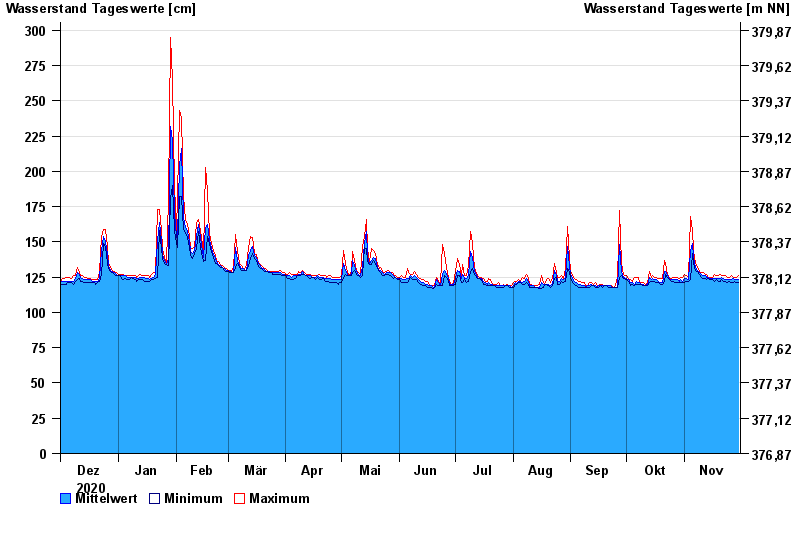
Chart of year Schlehenmühle / Roter Main
Waterlevel from 01.12.2020 to 30.11.2021
- 26.01.1995 Wasserstand: 399 cm
- 06.06.1984 Wasserstand: 363 cm
- 13.01.2011 Wasserstand: 337 cm
- 07.02.1984 Wasserstand: 324 cm
- 21.03.2002 Wasserstand: 323 cm
| Date | Mean value [cm] | Maximum [cm] | Minimum [cm] |
|---|---|---|---|
| 30.11.2021 | 123 | 126 | 121 |
| 29.11.2021 | 123 | 125 | 121 |
| 28.11.2021 | 123 | 125 | 122 |
| 27.11.2021 | 124 | 125 | 121 |
| 26.11.2021 | 123 | 126 | 121 |
| 25.11.2021 | 123 | 125 | 122 |
| 24.11.2021 | 123 | 125 | 121 |
© Bayerisches Landesamt für Umwelt 2024