
- Start >
- Rivers >
- Waterlevel >
- Oberer Main - Elbe >
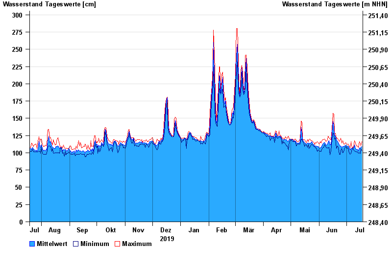
- Röbersdorf >
- Chart of year

Chart of year Röbersdorf / Reiche Ebrach
Waterlevel from 19.07.2019 to 18.07.2020
- 26.01.1995 Wasserstand: 410 cm
- 29.10.1998 Wasserstand: 394 cm
- 21.12.1993 Wasserstand: 390 cm
- 03.01.2003 Wasserstand: 381 cm
- 01.03.1987 Wasserstand: 381 cm
| Date | Mean value [cm] | Maximum [cm] | Minimum [cm] |
|---|---|---|---|
| 18.07.2020 | 109 | 116 | 103 |
| 17.07.2020 | 108 | 110 | 106 |
| 16.07.2020 | 107 | 113 | 99 |
| 15.07.2020 | 107 | 116 | 100 |
| 14.07.2020 | 103 | 108 | 99 |
| 13.07.2020 | 105 | 110 | 101 |
| 12.07.2020 | 105 | 110 | 101 |
© Bayerisches Landesamt für Umwelt 2024