
- Start >
- Rivers >
- Waterlevel >
- Oberer Main - Elbe >
- Röbersdorf >
- Chart of year

Chart of year Röbersdorf / Reiche Ebrach
Waterlevel from 14.12.2019 to 13.12.2020
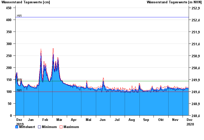
| Date | Mean value [cm] | Maximum [cm] | Minimum [cm] |
|---|---|---|---|
| 13.12.2020 | 114 | 117 | 112 |
| 12.12.2020 | 114 | 118 | 109 |
| 11.12.2020 | 115 | 117 | 113 |
| 10.12.2020 | 115 | 118 | 112 |
| 09.12.2020 | 115 | 118 | 111 |
| 08.12.2020 | 116 | 119 | 113 |
| 07.12.2020 | 113 | 119 | 111 |
© Bayerisches Landesamt für Umwelt 2024