
- Start >
- Rivers >
- Waterlevel >
- Oberer Main - Elbe >
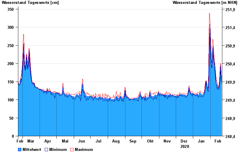
- Röbersdorf >
- Chart of year

Chart of year Röbersdorf / Reiche Ebrach
Waterlevel from 22.02.2020 to 21.02.2021
- 26.01.1995 Wasserstand: 410 cm
- 29.10.1998 Wasserstand: 394 cm
- 21.12.1993 Wasserstand: 390 cm
- 03.01.2003 Wasserstand: 381 cm
- 01.03.1987 Wasserstand: 381 cm
| Date | Mean value [cm] | Maximum [cm] | Minimum [cm] |
|---|---|---|---|
| 21.02.2021 | 152 | 158 | 145 |
| 20.02.2021 | 176 | 195 | 158 |
| 19.02.2021 | 196 | 201 | 185 |
| 18.02.2021 | 171 | 185 | 155 |
| 17.02.2021 | 142 | 155 | 133 |
| 16.02.2021 | 133 | 135 | 128 |
| 15.02.2021 | 132 | 135 | 129 |
© Bayerisches Landesamt für Umwelt 2024