
- Start >
- Rivers >
- Waterlevel >
- Oberer Main - Elbe >
- Röbersdorf >
- Chart of year

Chart of year Röbersdorf / Reiche Ebrach
Waterlevel from 05.06.2023 to 04.06.2024
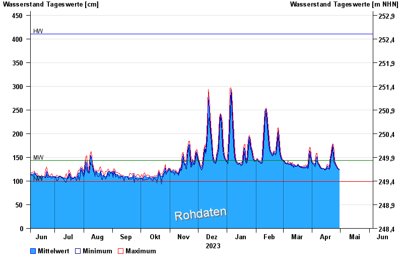
| Date | Mean value [cm] | Maximum [cm] | Minimum [cm] |
|---|---|---|---|
| 30.04.2024 | 124 | 125 | 123 |
| 29.04.2024 | 126 | 127 | 125 |
| 28.04.2024 | 128 | 130 | 127 |
| 27.04.2024 | 131 | 132 | 130 |
| 26.04.2024 | 135 | 137 | 132 |
| 25.04.2024 | 139 | 141 | 137 |
| 24.04.2024 | 156 | 176 | 140 |
© Bayerisches Landesamt für Umwelt 2024