
- Start >
- Rivers >
- Waterlevel >
- Oberer Main - Elbe >
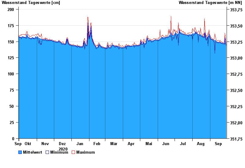
- Pottenstein >
- Chart of year

Chart of year Pottenstein / Püttlach
Waterlevel from 30.09.2020 to 29.09.2021
note
Abfluss durch starke Verkrautung behindert; Abflusswerte unsicher
- 23.02.1970 Wasserstand: 245 cm
- 13.01.2011 Wasserstand: 238 cm
- 26.01.1995 Wasserstand: 227 cm
- 29.10.1998 Wasserstand: 208 cm
- 21.12.1993 Wasserstand: 205 cm
| Date | Mean value [cm] | Maximum [cm] | Minimum [cm] |
|---|---|---|---|
| 29.09.2021 | 146 | 148 | 144 |
| 28.09.2021 | 149 | 153 | 147 |
| 27.09.2021 | 156 | 163 | 148 |
| 26.09.2021 | 147 | 154 | 146 |
| 25.09.2021 | 147 | 148 | 146 |
| 24.09.2021 | 147 | 148 | 147 |
| 23.09.2021 | 148 | 149 | 146 |
© Bayerisches Landesamt für Umwelt 2024