
- Start >
- Rivers >
- Waterlevel >
- Oberer Main - Elbe >
- Plankenfels >
- Chart of year

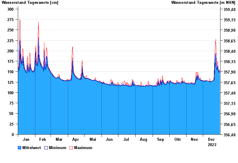
Chart of year Plankenfels / Truppach
Waterlevel from 01.01.2022 to 31.12.2022
- 22.07.1992 Wasserstand: 323 cm
- 26.01.1995 Wasserstand: 320 cm
- 23.01.1995 Wasserstand: 306 cm
- 21.03.2002 Wasserstand: 304 cm
- 29.10.1998 Wasserstand: 304 cm
| Date | Mean value [cm] | Maximum [cm] | Minimum [cm] |
|---|---|---|---|
| 31.12.2022 | 153 | 155 | 149 |
| 30.12.2022 | 149 | 151 | 148 |
| 29.12.2022 | 151 | 152 | 149 |
| 28.12.2022 | 155 | 158 | 152 |
| 27.12.2022 | 166 | 175 | 158 |
| 26.12.2022 | 157 | 167 | 154 |
| 25.12.2022 | 161 | 168 | 157 |
© Bayerisches Landesamt für Umwelt 2024