
- Start >
- Rivers >
- Waterlevel >
- Oberer Main - Elbe >
- Oberlauter >
- Chart of month

Chart of month Oberlauter / Lauterbach
Waterlevel from 01.06.2020 to 30.06.2020
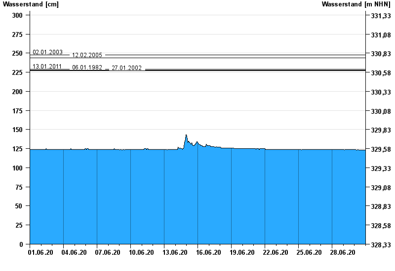
- 02.01.2003 Wasserstand: 248 cm
- 12.02.2005 Wasserstand: 244 cm
- 13.01.2011 Wasserstand: 229 cm
- 06.01.1982 Wasserstand: 228 cm
- 27.01.2002 Wasserstand: 227 cm
| Date | Waterlevel [cm] |
|---|---|
| 01.07.2020 00:45 | 123 |
| 01.07.2020 00:30 | 123 |
| 01.07.2020 00:15 | 123 |
| 01.07.2020 00:00 | 123 |
| 30.06.2020 23:45 | 123 |
| 30.06.2020 23:30 | 123 |
| 30.06.2020 23:15 | 123 |
© Bayerisches Landesamt für Umwelt 2024