
- Start >
- Rivers >
- Waterlevel >
- Oberer Main - Elbe >
- Oberkotzau >
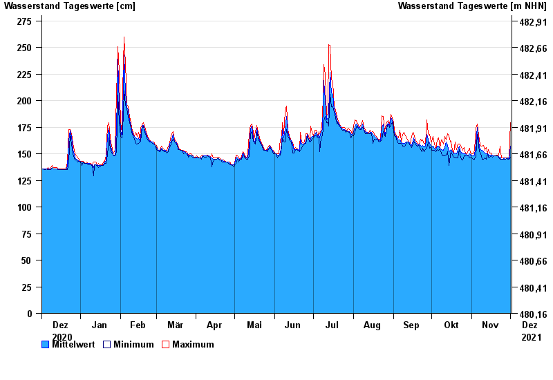
- Chart of year

Chart of year Oberkotzau / Sächsische Saale
Waterlevel from 02.12.2020 to 01.12.2021
- 01.11.1998 Wasserstand: 391 cm
- 23.01.1995 Wasserstand: 369 cm
- 06.01.1982 Wasserstand: 368 cm
- 26.02.2002 Wasserstand: 360 cm
- 14.01.2011 Wasserstand: 354 cm
| Date | Mean value [cm] | Maximum [cm] | Minimum [cm] |
|---|---|---|---|
| 01.12.2021 | 157 | 179 | 147 |
| 30.11.2021 | 145 | 147 | 145 |
| 29.11.2021 | 146 | 146 | 145 |
| 28.11.2021 | 146 | 146 | 146 |
| 27.11.2021 | 145 | 146 | 145 |
| 26.11.2021 | 146 | 146 | 145 |
| 25.11.2021 | 145 | 146 | 145 |
© Bayerisches Landesamt für Umwelt 2024