
- Start >
- Rivers >
- Waterlevel >
- Oberer Main - Elbe >
- Oberkotzau >
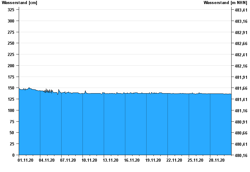
- Chart of month

Chart of month Oberkotzau / Sächsische Saale
Waterlevel from 01.11.2020 to 30.11.2020
- 01.11.1998 Wasserstand: 391 cm
- 23.01.1995 Wasserstand: 369 cm
- 06.01.1982 Wasserstand: 368 cm
- 26.02.2002 Wasserstand: 360 cm
- 14.01.2011 Wasserstand: 354 cm
| Date | Waterlevel [cm] |
|---|---|
| 30.11.2020 23:45 | 136 |
| 30.11.2020 23:30 | 136 |
| 30.11.2020 23:15 | 136 |
| 30.11.2020 23:00 | 136 |
| 30.11.2020 22:45 | 136 |
| 30.11.2020 22:30 | 136 |
| 30.11.2020 22:15 | 136 |
© Bayerisches Landesamt für Umwelt 2024