
- Start >
- Rivers >
- Waterlevel >
- Oberer Main - Elbe >
- Neukenroth >
- Chart of year

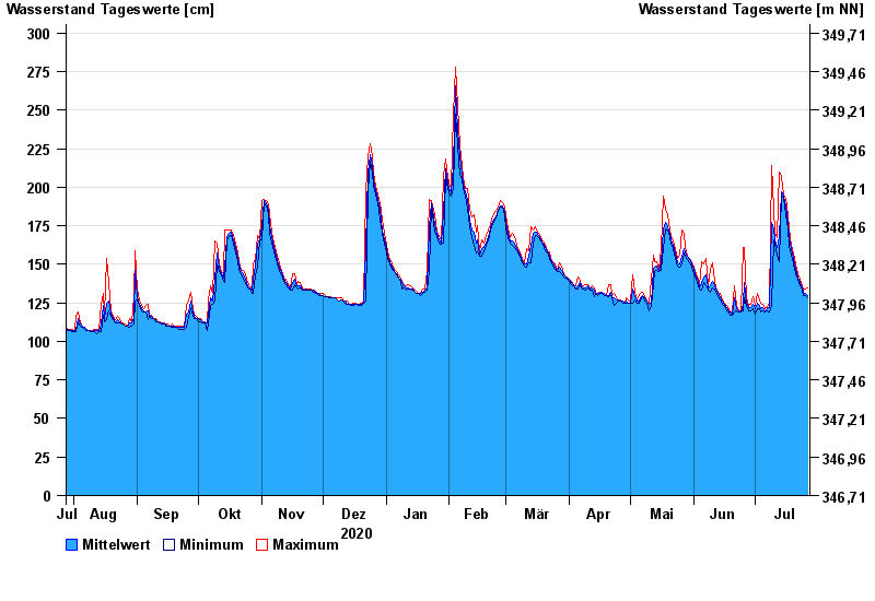
Chart of year Neukenroth / Haßlach
Waterlevel from 28.07.2020 to 27.07.2021
- 10.03.1981 Wasserstand: 340 cm
- 24.12.1967 Wasserstand: 331 cm
- 27.01.2002 Wasserstand: 320 cm
- 03.01.2003 Wasserstand: 314 cm
- 06.01.1982 Wasserstand: 307 cm
| Date | Mean value [cm] | Maximum [cm] | Minimum [cm] |
|---|---|---|---|
| 27.07.2021 | 130 | 135 | 128 |
| 26.07.2021 | 131 | 134 | 130 |
| 25.07.2021 | 132 | 133 | 130 |
| 24.07.2021 | 135 | 136 | 133 |
| 23.07.2021 | 138 | 140 | 136 |
| 22.07.2021 | 142 | 144 | 140 |
| 21.07.2021 | 147 | 150 | 144 |
© Bayerisches Landesamt für Umwelt 2024