
- Start >
- Rivers >
- Waterlevel >
- Oberer Main - Elbe >
- Neukenroth >
- Chart of year

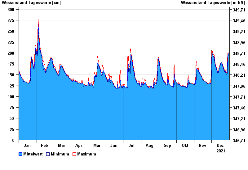
Chart of year Neukenroth / Haßlach
Waterlevel from 01.01.2021 to 31.12.2021
- 10.03.1981 Wasserstand: 340 cm
- 24.12.1967 Wasserstand: 331 cm
- 27.01.2002 Wasserstand: 320 cm
- 03.01.2003 Wasserstand: 314 cm
- 06.01.1982 Wasserstand: 307 cm
| Date | Mean value [cm] | Maximum [cm] | Minimum [cm] |
|---|---|---|---|
| 31.12.2021 | 200 | 201 | 199 |
| 30.12.2021 | 198 | 200 | 196 |
| 29.12.2021 | 195 | 199 | 184 |
| 28.12.2021 | 162 | 184 | 153 |
| 27.12.2021 | 154 | 155 | 151 |
| 26.12.2021 | 153 | 155 | 152 |
| 25.12.2021 | 157 | 159 | 155 |
© Bayerisches Landesamt für Umwelt 2024