
- Start >
- Rivers >
- Waterlevel >
- Oberer Main - Elbe >
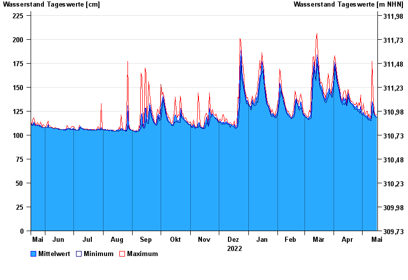
- Mönchröden >
- Chart of year

Chart of year Mönchröden / Röden
Waterlevel from 17.05.2022 to 16.05.2023
- 0 cm: Stadt Coburg: Ergänzung zum Pegel Schönstädt/Itz. Nur Info in Verbindung mit dem Zufluss durch die Itz.
| Date | Mean value [cm] | Maximum [cm] | Minimum [cm] |
|---|---|---|---|
| 16.05.2023 | 119 | 121 | 118 |
| 15.05.2023 | 120 | 121 | 119 |
| 14.05.2023 | 121 | 122 | 120 |
| 13.05.2023 | 123 | 126 | 122 |
| 12.05.2023 | 132 | 143 | 126 |
| 11.05.2023 | 135 | 177 | 121 |
| 10.05.2023 | 118 | 121 | 115 |
© Bayerisches Landesamt für Umwelt 2024