
- Start >
- Rivers >
- Waterlevel >
- Oberer Main - Elbe >
- Mauthaus >
- Chart of year

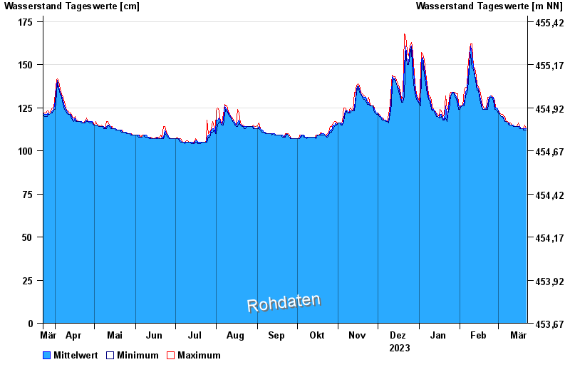
Chart of year Mauthaus / Tschirner Ködel
Waterlevel from 23.03.2023 to 22.03.2024
- 14.02.1997 Wasserstand: 209 cm
- 03.01.2003 Wasserstand: 188 cm
- 27.01.2002 Wasserstand: 186 cm
- 13.02.2005 Wasserstand: 182 cm
- 24.12.1967 Wasserstand: 180 cm
| Date | Mean value [cm] | Maximum [cm] | Minimum [cm] |
|---|---|---|---|
| 22.03.2024 | 113 | 113 | 112 |
| 21.03.2024 | 113 | 115 | 112 |
| 20.03.2024 | 113 | 113 | 112 |
| 19.03.2024 | 113 | 113 | 113 |
| 18.03.2024 | 113 | 113 | 113 |
| 17.03.2024 | 114 | 114 | 113 |
| 16.03.2024 | 114 | 116 | 114 |
© Bayerisches Landesamt für Umwelt 2024