
- Start >
- Rivers >
- Waterlevel >
- Oberer Main - Elbe >
- Mauthaus >
- Chart of year

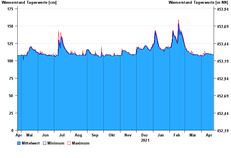
Chart of year Mauthaus / Nordhalbener Ködel
Waterlevel from 24.04.2021 to 23.04.2022
- 13.02.1997 Wasserstand: 211 cm
- 03.01.2003 Wasserstand: 191 cm
- 27.01.2002 Wasserstand: 185 cm
- 30.12.1996 Wasserstand: 185 cm
- 06.01.1982 Wasserstand: 181 cm
| Date | Mean value [cm] | Maximum [cm] | Minimum [cm] |
|---|---|---|---|
| 23.04.2022 | 109 | 109 | 108 |
| 22.04.2022 | 109 | 109 | 109 |
| 21.04.2022 | 109 | 109 | 109 |
| 20.04.2022 | 109 | 109 | 109 |
| 19.04.2022 | 109 | 110 | 109 |
| 18.04.2022 | 110 | 110 | 109 |
| 17.04.2022 | 110 | 110 | 110 |
© Bayerisches Landesamt für Umwelt 2024