
- Start >
- Rivers >
- Waterlevel >
- Oberer Main - Elbe >
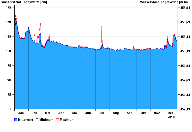
- Mauthaus >
- Chart of year

Chart of year Mauthaus / Nordhalbener Ködel
Waterlevel from 01.01.2018 to 31.12.2018
- 13.02.1997 Wasserstand: 211 cm
- 03.01.2003 Wasserstand: 191 cm
- 27.01.2002 Wasserstand: 185 cm
- 30.12.1996 Wasserstand: 185 cm
- 06.01.1982 Wasserstand: 181 cm
| Date | Mean value [cm] | Maximum [cm] | Minimum [cm] |
|---|---|---|---|
| 31.12.2018 | 117 | 118 | 117 |
| 30.12.2018 | 118 | 118 | 118 |
| 29.12.2018 | 118 | 118 | 118 |
| 28.12.2018 | 119 | 121 | 118 |
| 27.12.2018 | 121 | 123 | 120 |
| 26.12.2018 | 125 | 127 | 123 |
| 25.12.2018 | 127 | 128 | 127 |
© Bayerisches Landesamt für Umwelt 2024