
- Start >
- Rivers >
- Waterlevel >
- Oberer Main - Elbe >
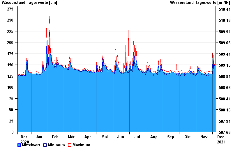
- Marktredwitz >
- Chart of year

Chart of year Marktredwitz / Kössein
Waterlevel from 07.12.2020 to 06.12.2021
- 01.11.1998 Wasserstand: 314 cm
- 29.06.2006 Wasserstand: 312 cm
- 12.02.2005 Wasserstand: 307 cm
- 26.01.1995 Wasserstand: 303 cm
- 21.12.1993 Wasserstand: 293 cm
| Date | Mean value [cm] | Maximum [cm] | Minimum [cm] |
|---|---|---|---|
| 06.12.2021 | 142 | 146 | 139 |
| 05.12.2021 | 149 | 152 | 141 |
| 04.12.2021 | 140 | 141 | 139 |
| 03.12.2021 | 146 | 153 | 141 |
| 02.12.2021 | 168 | 178 | 153 |
| 01.12.2021 | 147 | 177 | 131 |
| 30.11.2021 | 130 | 134 | 125 |
© Bayerisches Landesamt für Umwelt 2024