
- Start >
- Rivers >
- Waterlevel >
- Oberer Main - Elbe >
- Marktredwitz >
- Chart of year

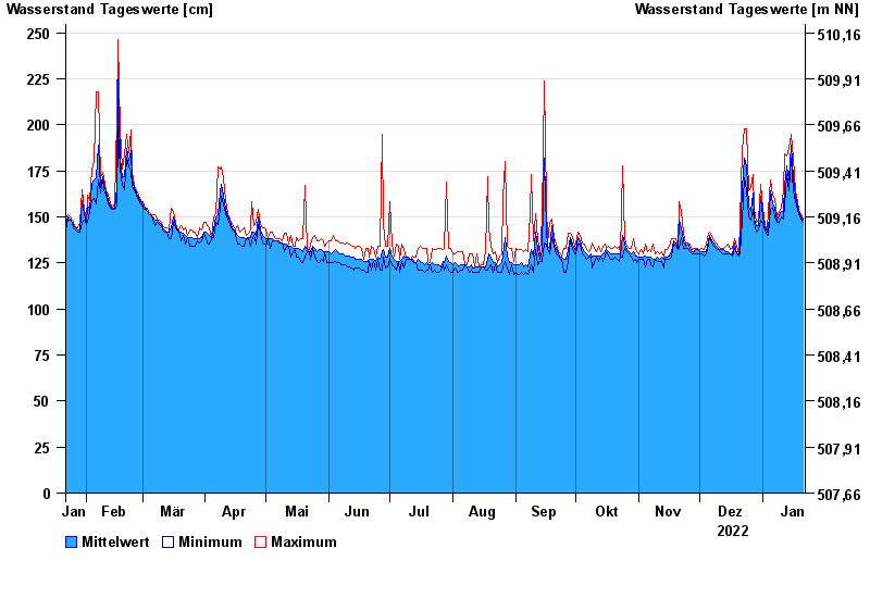
Chart of year Marktredwitz / Kössein
Waterlevel from 22.01.2022 to 21.01.2023
- 01.11.1998 Wasserstand: 314 cm
- 29.06.2006 Wasserstand: 312 cm
- 12.02.2005 Wasserstand: 307 cm
- 26.01.1995 Wasserstand: 303 cm
- 21.12.1993 Wasserstand: 293 cm
| Date | Mean value [cm] | Maximum [cm] | Minimum [cm] |
|---|---|---|---|
| 21.01.2023 | 148 | 149 | 147 |
| 20.01.2023 | 150 | 151 | 149 |
| 19.01.2023 | 153 | 154 | 151 |
| 18.01.2023 | 156 | 158 | 154 |
| 17.01.2023 | 161 | 164 | 158 |
| 16.01.2023 | 171 | 182 | 164 |
| 15.01.2023 | 189 | 195 | 182 |
© Bayerisches Landesamt für Umwelt 2024