
- Start >
- Rivers >
- Waterlevel >
- Oberer Main - Elbe >
- Marktredwitz >
- Chart of month

Chart of month Marktredwitz / Kössein
Waterlevel from 01.10.2022 to 31.10.2022
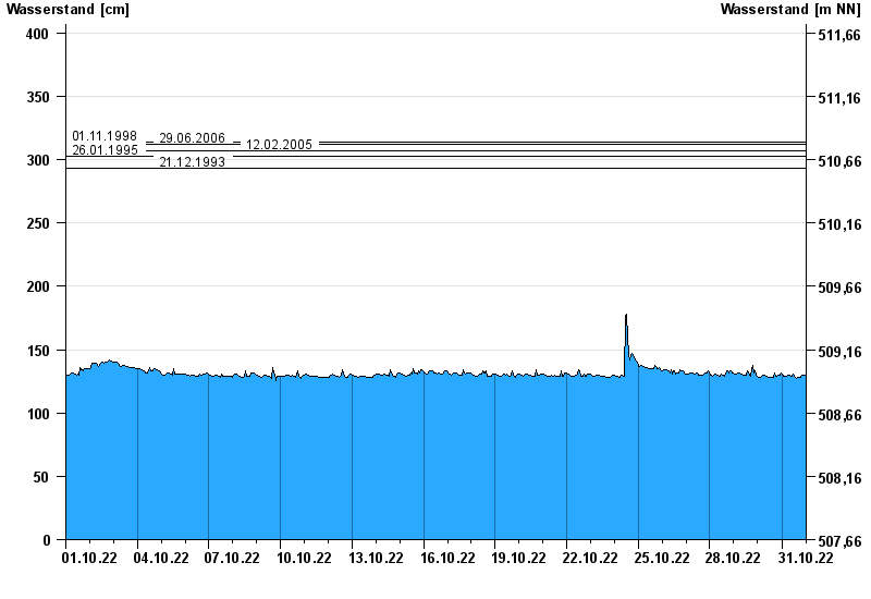
- 01.11.1998 Wasserstand: 314 cm
- 29.06.2006 Wasserstand: 312 cm
- 12.02.2005 Wasserstand: 307 cm
- 26.01.1995 Wasserstand: 303 cm
- 21.12.1993 Wasserstand: 293 cm
| Date | Waterlevel [cm] |
|---|---|
| 31.10.2022 23:45 | 129 |
| 31.10.2022 23:30 | 129 |
| 31.10.2022 23:15 | 130 |
| 31.10.2022 23:00 | 130 |
| 31.10.2022 22:45 | 130 |
| 31.10.2022 22:30 | 130 |
| 31.10.2022 22:15 | 130 |
© Bayerisches Landesamt für Umwelt 2024