
- Start >
- Rivers >
- Waterlevel >
- Oberer Main - Elbe >
- Marktredwitz >
- Chart of month

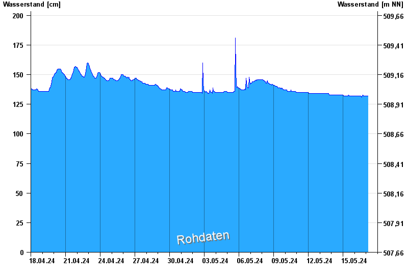
Chart of month Marktredwitz / Kössein
Waterlevel from 18.04.2024 to 17.05.2024
- Hochwassergefahrenfläche HQhäufig 300 cm
| Date | Waterlevel [cm] |
|---|---|
| 30.04.2024 07:15 | 136 |
| 30.04.2024 07:00 | 136 |
| 30.04.2024 06:45 | 136 |
| 30.04.2024 06:30 | 136 |
| 30.04.2024 06:15 | 137 |
| 30.04.2024 06:00 | 137 |
| 30.04.2024 05:45 | 137 |
© Bayerisches Landesamt für Umwelt 2024