
- Start >
- Rivers >
- Waterlevel >
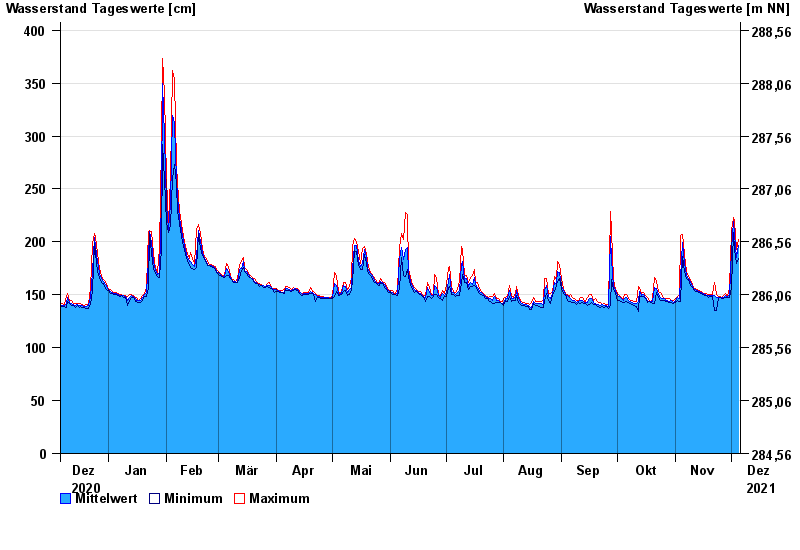
- Oberer Main - Elbe >
- Mainleus >
- Chart of year

Chart of year Mainleus / Main
Waterlevel from 06.12.2020 to 05.12.2021
- 26.01.1995 Wasserstand: 442 cm
- 13.02.2005 Wasserstand: 421 cm
- 14.01.2011 Wasserstand: 418 cm
- 21.12.1993 Wasserstand: 414 cm
- 28.05.2006 Wasserstand: 412 cm
| Date | Mean value [cm] | Maximum [cm] | Minimum [cm] |
|---|---|---|---|
| 05.12.2021 | 197 | 202 | 184 |
| 04.12.2021 | 185 | 193 | 180 |
| 03.12.2021 | 207 | 220 | 193 |
| 02.12.2021 | 219 | 223 | 209 |
| 01.12.2021 | 193 | 211 | 157 |
| 30.11.2021 | 149 | 157 | 147 |
| 29.11.2021 | 148 | 148 | 147 |
© Bayerisches Landesamt für Umwelt 2024