
- Start >
- Rivers >
- Waterlevel >
- Oberer Main - Elbe >
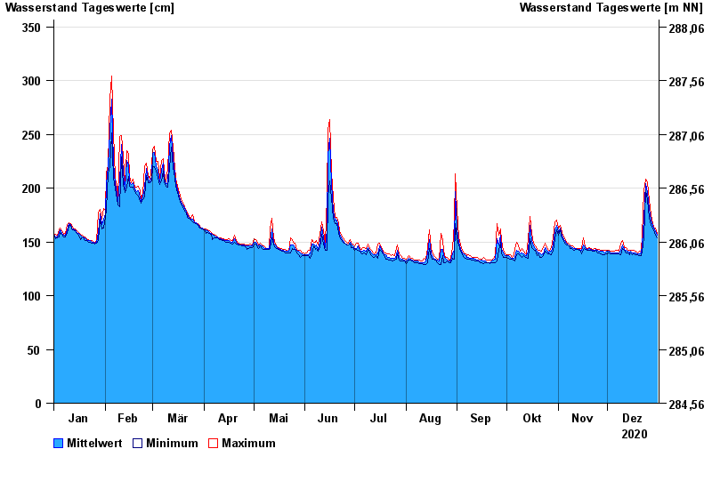
- Mainleus >
- Chart of year

Chart of year Mainleus / Main
Waterlevel from 01.01.2020 to 31.12.2020
- 26.01.1995 Wasserstand: 442 cm
- 13.02.2005 Wasserstand: 421 cm
- 14.01.2011 Wasserstand: 418 cm
- 21.12.1993 Wasserstand: 414 cm
- 28.05.2006 Wasserstand: 412 cm
| Date | Mean value [cm] | Maximum [cm] | Minimum [cm] |
|---|---|---|---|
| 31.12.2020 | 156 | 158 | 154 |
| 30.12.2020 | 160 | 163 | 156 |
| 29.12.2020 | 163 | 164 | 161 |
| 28.12.2020 | 165 | 167 | 162 |
| 27.12.2020 | 170 | 175 | 166 |
| 26.12.2020 | 181 | 189 | 172 |
| 25.12.2020 | 196 | 205 | 189 |
© Bayerisches Landesamt für Umwelt 2024