
- Start >
- Rivers >
- Waterlevel >
- Oberer Main - Elbe >
- Mainleus >
- Chart of month

Chart of month Mainleus / Main
Waterlevel from 02.12.2021 to 01.01.2022
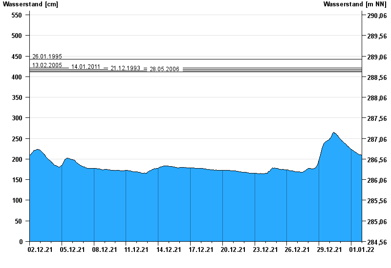
- 26.01.1995 Wasserstand: 442 cm
- 13.02.2005 Wasserstand: 421 cm
- 14.01.2011 Wasserstand: 418 cm
- 21.12.1993 Wasserstand: 414 cm
- 28.05.2006 Wasserstand: 412 cm
| Date | Waterlevel [cm] |
|---|---|
| 01.01.2022 23:45 | 208 |
| 01.01.2022 23:30 | 208 |
| 01.01.2022 23:15 | 208 |
| 01.01.2022 23:00 | 209 |
| 01.01.2022 22:45 | 209 |
| 01.01.2022 22:30 | 209 |
| 01.01.2022 22:15 | 209 |
© Bayerisches Landesamt für Umwelt 2024