
- Start >
- Rivers >
- Waterlevel >
- Oberer Main - Elbe >
- Laufermühle >
- Chart of year

Chart of year Laufermühle / Aisch
Waterlevel from 01.01.2021 to 31.12.2021
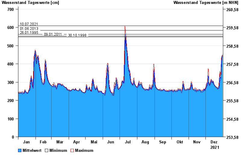
- 10.07.2021 Wasserstand: 609 cm
- 01.06.2013 Wasserstand: 584 cm
- 26.01.1995 Wasserstand: 563 cm
- 09.01.2011 Wasserstand: 553 cm
- 30.10.1998 Wasserstand: 548 cm
| Date | Mean value [cm] | Maximum [cm] | Minimum [cm] |
|---|---|---|---|
| 31.12.2021 | 447 | 449 | 444 |
| 30.12.2021 | 437 | 444 | 430 |
| 29.12.2021 | 417 | 430 | 364 |
| 28.12.2021 | 331 | 364 | 315 |
| 27.12.2021 | 319 | 335 | 310 |
| 26.12.2021 | 344 | 360 | 308 |
| 25.12.2021 | 279 | 308 | 267 |
© Bayerisches Landesamt für Umwelt 2024