
- Start >
- Rivers >
- Waterlevel >
- Oberer Main - Elbe >
- Laufermühle >
- Current values

Current values Laufermühle / Aisch
Waterlevel from 15.05.2021 to 22.05.2021
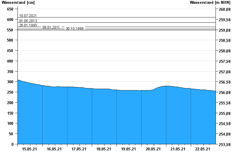
- 10.07.2021 Wasserstand: 609 cm
- 01.06.2013 Wasserstand: 584 cm
- 26.01.1995 Wasserstand: 563 cm
- 09.01.2011 Wasserstand: 553 cm
- 30.10.1998 Wasserstand: 548 cm
| Date | Waterlevel [cm] |
|---|---|
| 23.05.2021 00:45 | 256 |
| 23.05.2021 00:30 | 256 |
| 23.05.2021 00:15 | 256 |
| 23.05.2021 00:00 | 256 |
| 22.05.2021 23:45 | 256 |
| 22.05.2021 23:30 | 256 |
| 22.05.2021 23:15 | 256 |
© Bayerisches Landesamt für Umwelt 2024