
- Start >
- Rivers >
- Waterlevel >
- Oberer Main - Elbe >
- Kautendorf >
- Chart of year

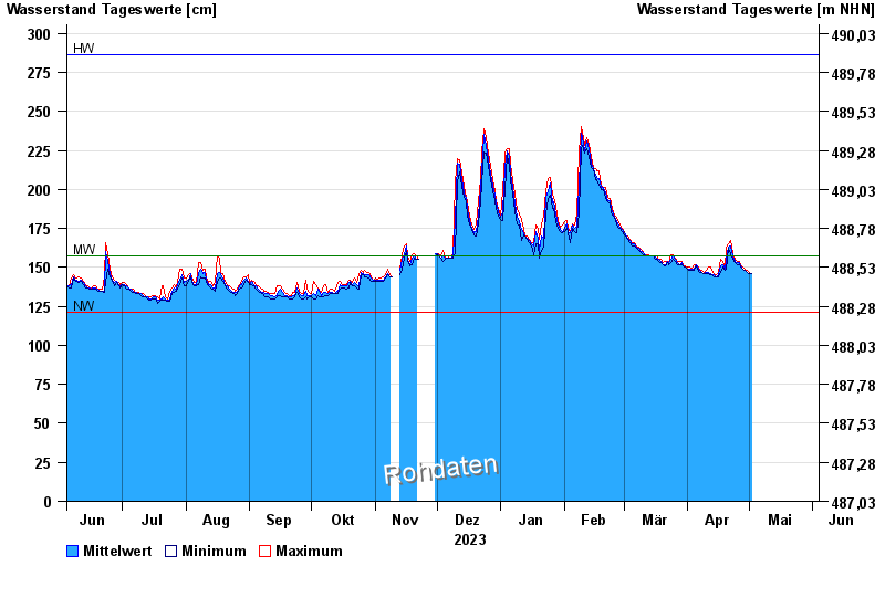
Chart of year Kautendorf / Südliche Regnitz
Waterlevel from 04.06.2023 to 03.06.2024
note
| Date | Mean value [cm] | Maximum [cm] | Minimum [cm] |
|---|---|---|---|
| 03.06.2024 | 238 | 241 | 231 |
| 02.06.2024 | 222 | 240 | 205 |
| 01.06.2024 | 177 | 204 | 152 |
| 31.05.2024 | 155 | 157 | 152 |
| 30.05.2024 | 152 | 157 | 148 |
| 29.05.2024 | 150 | 151 | 148 |
| 28.05.2024 | 150 | 151 | 148 |
© Bayerisches Landesamt für Umwelt 2024