
- Start >
- Rivers >
- Waterlevel >
- Oberer Main - Elbe >
- Kalteneck >
- Chart of year

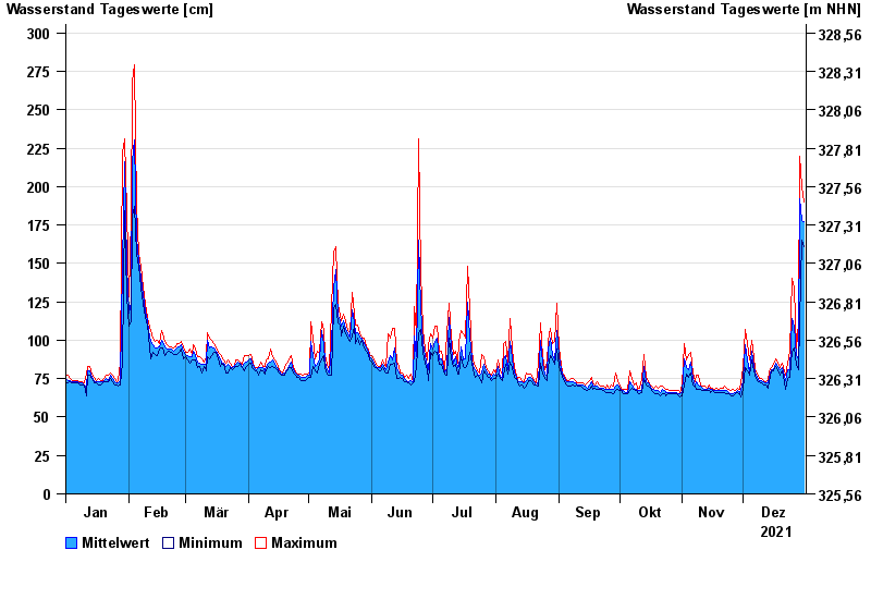
Chart of year Kalteneck / Ilz
Waterlevel from 01.01.2021 to 31.12.2021
- 21.12.1993 Wasserstand: 477 cm
- 16.03.2019 Wasserstand: 439 cm
- 21.03.2002 Wasserstand: 400 cm
- 12.08.2002 Wasserstand: 396 cm
- 12.03.1981 Wasserstand: 395 cm
| Date | Mean value [cm] | Maximum [cm] | Minimum [cm] |
|---|---|---|---|
| 31.12.2021 | 177 | 190 | 161 |
| 30.12.2021 | 178 | 200 | 165 |
| 29.12.2021 | 192 | 220 | 111 |
| 28.12.2021 | 87 | 111 | 81 |
| 27.12.2021 | 90 | 95 | 84 |
| 26.12.2021 | 109 | 134 | 95 |
| 25.12.2021 | 114 | 140 | 93 |
© Bayerisches Landesamt für Umwelt 2024