
- Start >
- Rivers >
- Waterlevel >
- Oberer Main - Elbe >
- Kalteneck >
- Chart of year

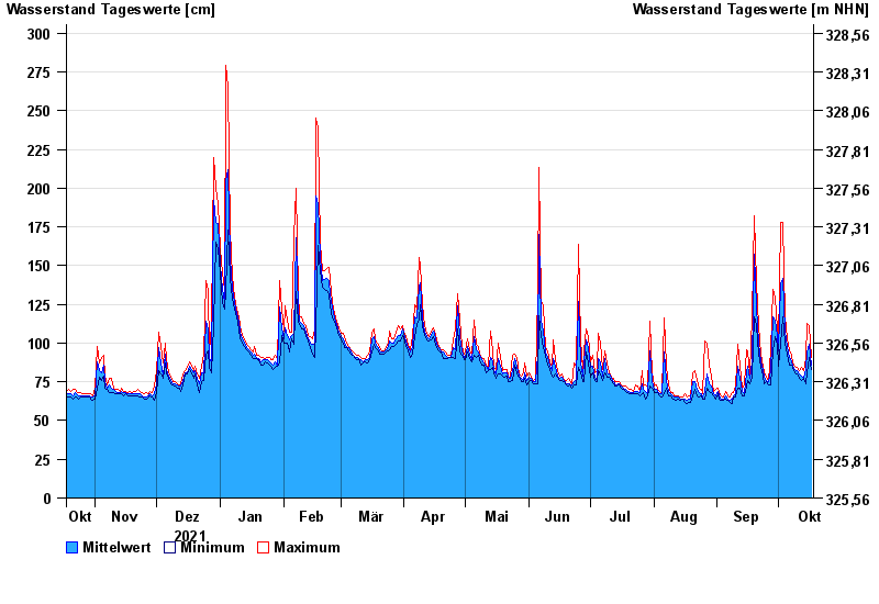
Chart of year Kalteneck / Ilz
Waterlevel from 18.10.2021 to 17.10.2022
- 21.12.1993 Wasserstand: 477 cm
- 16.03.2019 Wasserstand: 439 cm
- 21.03.2002 Wasserstand: 400 cm
- 12.08.2002 Wasserstand: 396 cm
- 12.03.1981 Wasserstand: 395 cm
| Date | Mean value [cm] | Maximum [cm] | Minimum [cm] |
|---|---|---|---|
| 17.10.2022 | 86 | 91 | 83 |
| 16.10.2022 | 99 | 111 | 91 |
| 15.10.2022 | 94 | 113 | 81 |
| 14.10.2022 | 83 | 90 | 74 |
| 13.10.2022 | 78 | 82 | 77 |
| 12.10.2022 | 79 | 84 | 76 |
| 11.10.2022 | 80 | 82 | 77 |
© Bayerisches Landesamt für Umwelt 2024