
- Start >
- Rivers >
- Waterlevel >
- Oberer Main - Elbe >
- Kalteneck >
- Current values

Current values Kalteneck / Ilz
Waterlevel from 20.06.2021 to 27.06.2021
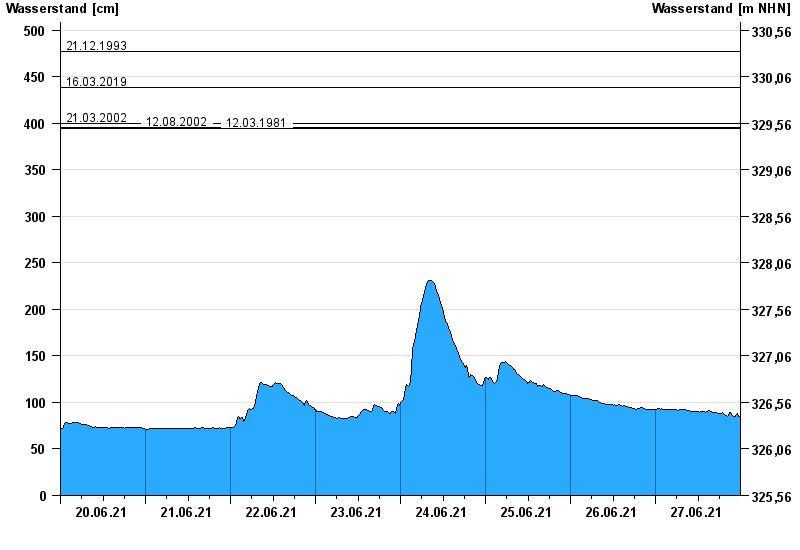
- 21.12.1993 Wasserstand: 477 cm
- 16.03.2019 Wasserstand: 439 cm
- 21.03.2002 Wasserstand: 400 cm
- 12.08.2002 Wasserstand: 396 cm
- 12.03.1981 Wasserstand: 395 cm
| Date | Waterlevel [cm] |
|---|---|
| 28.06.2021 00:45 | 87 |
| 28.06.2021 00:30 | 85 |
| 28.06.2021 00:15 | 85 |
| 28.06.2021 00:00 | 85 |
| 27.06.2021 23:45 | 85 |
| 27.06.2021 23:30 | 85 |
| 27.06.2021 23:15 | 86 |
© Bayerisches Landesamt für Umwelt 2024