
- Start >
- Rivers >
- Waterlevel >
- Oberer Main - Elbe >
- Hof >
- Chart of year

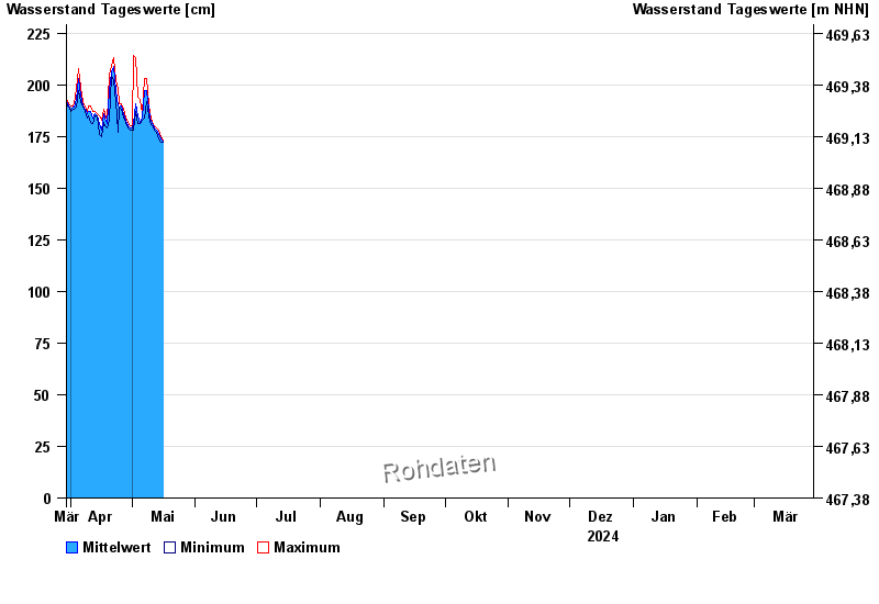
Chart of year Hof / Sächsische Saale
Waterlevel from 30.03.2024 to 29.03.2025
- 15.08.1924 Wasserstand: 428 cm
- 09.02.1946 Wasserstand: 420 cm
- 14.01.2011 Wasserstand: 416 cm
- 11.07.1954 Wasserstand: 414 cm
- 28.12.1947 Wasserstand: 410 cm
| Date | Mean value [cm] | Maximum [cm] | Minimum [cm] |
|---|---|---|---|
| 16.05.2024 | 173 | 173 | 172 |
| 15.05.2024 | 174 | 175 | 172 |
| 14.05.2024 | 176 | 178 | 174 |
| 13.05.2024 | 178 | 179 | 177 |
| 12.05.2024 | 179 | 180 | 178 |
| 11.05.2024 | 181 | 182 | 180 |
| 10.05.2024 | 184 | 186 | 182 |
© Bayerisches Landesamt für Umwelt 2024