
- Start >
- Rivers >
- Waterlevel >
- Oberer Main - Elbe >
- Hölle >
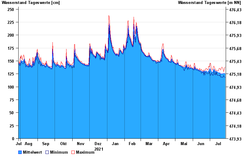
- Chart of year

Chart of year Hölle / Selbitz
Waterlevel from 29.07.2021 to 28.07.2022
- 06.01.1982 Wasserstand: 322 cm
- 14.01.2011 Wasserstand: 320 cm
- 24.12.1967 Wasserstand: 320 cm
- 01.11.1998 Wasserstand: 313 cm
- 03.01.2003 Wasserstand: 309 cm
| Date | Mean value [cm] | Maximum [cm] | Minimum [cm] |
|---|---|---|---|
| 28.07.2022 | 125 | 138 | 118 |
| 27.07.2022 | 126 | 137 | 119 |
| 26.07.2022 | 126 | 131 | 120 |
| 25.07.2022 | 126 | 129 | 122 |
| 24.07.2022 | 125 | 134 | 119 |
| 23.07.2022 | 125 | 137 | 118 |
| 22.07.2022 | 125 | 138 | 119 |
© Bayerisches Landesamt für Umwelt 2024