
- Start >
- Rivers >
- Waterlevel >
- Oberer Main - Elbe >
- Heinersdorf >
- Chart of year

Chart of year Heinersdorf / Rodach
Waterlevel from 08.04.2021 to 07.04.2022
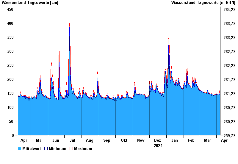
| Date | Mean value [cm] | Maximum [cm] | Minimum [cm] |
|---|---|---|---|
| 07.04.2022 | 149 | 161 | 145 |
| 06.04.2022 | 147 | 149 | 146 |
| 05.04.2022 | 145 | 148 | 143 |
| 04.04.2022 | 143 | 145 | 141 |
| 03.04.2022 | 145 | 148 | 144 |
| 02.04.2022 | 148 | 149 | 147 |
| 01.04.2022 | 146 | 148 | 145 |
© Bayerisches Landesamt für Umwelt 2024