
- Start >
- Rivers >
- Waterlevel >
- Oberer Main - Elbe >
- Heinersdorf >
- Current values

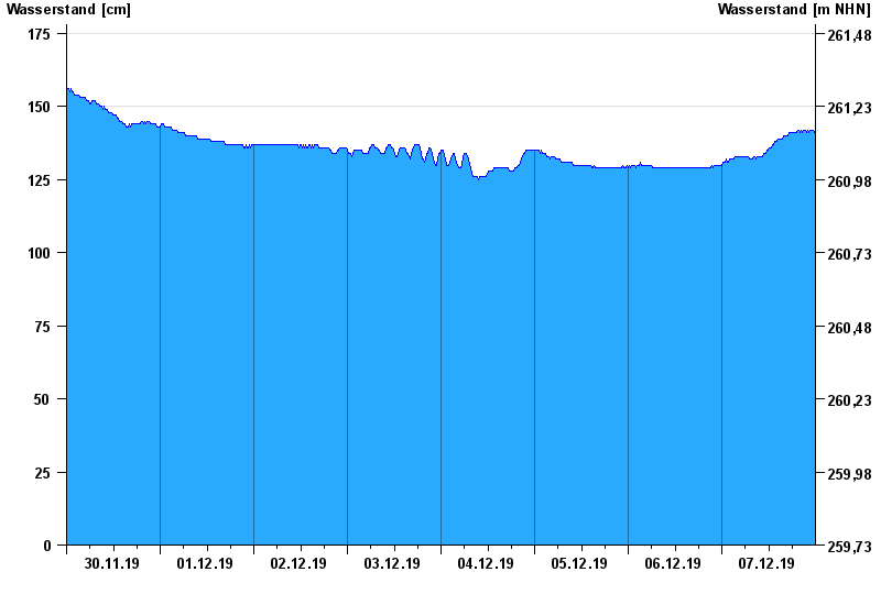
Current values Heinersdorf / Rodach
Waterlevel from 30.11.2019 to 07.12.2019
- Hochwassergefahrenfläche HQ100 420 cm
| Date | Waterlevel [cm] |
|---|---|
| 07.12.2019 23:45 | 141 |
| 07.12.2019 23:30 | 142 |
| 07.12.2019 23:15 | 142 |
| 07.12.2019 23:00 | 142 |
| 07.12.2019 22:45 | 142 |
| 07.12.2019 22:30 | 142 |
| 07.12.2019 22:15 | 141 |
© Bayerisches Landesamt für Umwelt 2024