
- Start >
- Rivers >
- Waterlevel >
- Oberer Main - Elbe >
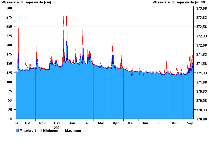
- Gampelmühle >
- Chart of year

Chart of year Gampelmühle / Ölschnitz
Waterlevel from 22.09.2021 to 21.09.2022
- 06.06.1984 Wasserstand: 357 cm
- 28.05.2006 Wasserstand: 348 cm
- 26.01.1995 Wasserstand: 344 cm
- 07.07.2006 Wasserstand: 343 cm
- 03.01.2003 Wasserstand: 340 cm
| Date | Mean value [cm] | Maximum [cm] | Minimum [cm] |
|---|---|---|---|
| 21.09.2022 | 136 | 141 | 132 |
| 20.09.2022 | 151 | 173 | 141 |
| 19.09.2022 | 150 | 167 | 144 |
| 18.09.2022 | 136 | 154 | 131 |
| 17.09.2022 | 130 | 138 | 127 |
| 16.09.2022 | 133 | 142 | 129 |
| 15.09.2022 | 154 | 178 | 141 |
© Bayerisches Landesamt für Umwelt 2024