
- Start >
- Rivers >
- Waterlevel >
- Oberer Main - Elbe >
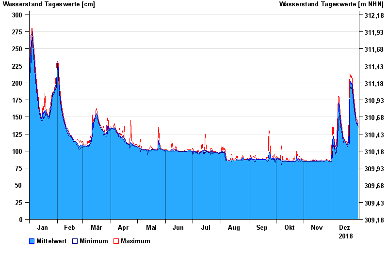
- Fürth am Berg >
- Chart of year

Chart of year Fürth am Berg / Steinach
Waterlevel from 01.01.2018 to 31.12.2018
- 15.09.1998 Wasserstand: 418 cm
- 28.01.2002 Wasserstand: 398 cm
- 03.01.2003 Wasserstand: 388 cm
- 03.03.1999 Wasserstand: 377 cm
- 01.11.1998 Wasserstand: 377 cm
| Date | Mean value [cm] | Maximum [cm] | Minimum [cm] |
|---|---|---|---|
| 31.12.2018 | 137 | 140 | 135 |
| 30.12.2018 | 142 | 146 | 140 |
| 29.12.2018 | 143 | 146 | 140 |
| 28.12.2018 | 150 | 155 | 146 |
| 27.12.2018 | 160 | 166 | 155 |
| 26.12.2018 | 173 | 181 | 166 |
| 25.12.2018 | 188 | 194 | 181 |
© Bayerisches Landesamt für Umwelt 2024