
- Start >
- Rivers >
- Waterlevel >
- Oberer Main - Elbe >
- Friedersdorf >
- Current values

Current values Friedersdorf / Buchbach
Waterlevel from 08.10.2022 to 15.10.2022
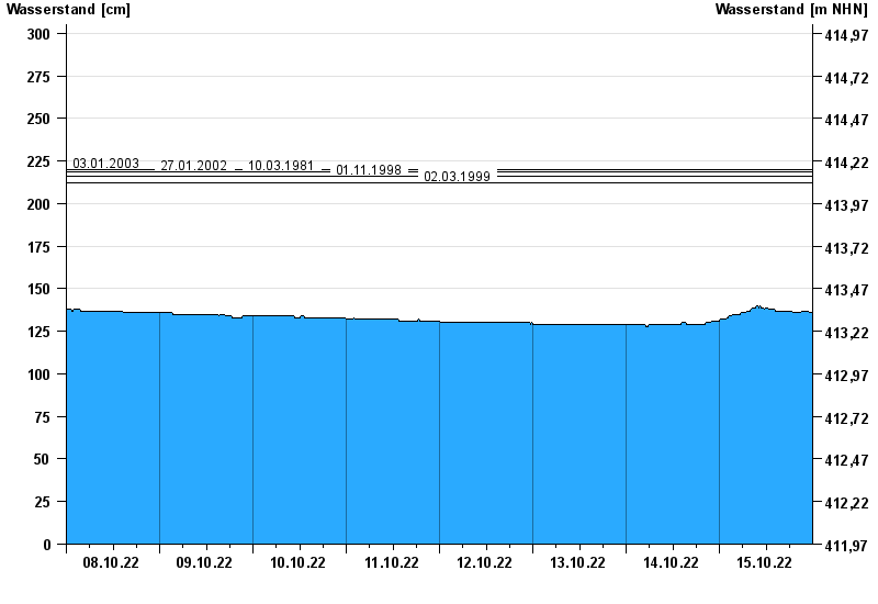
- 03.01.2003 Wasserstand: 220 cm
- 27.01.2002 Wasserstand: 219 cm
- 10.03.1981 Wasserstand: 219 cm
- 01.11.1998 Wasserstand: 216 cm
- 02.03.1999 Wasserstand: 212 cm
| Date | Waterlevel [cm] |
|---|---|
| 16.10.2022 00:45 | 136 |
| 16.10.2022 00:30 | 136 |
| 16.10.2022 00:15 | 136 |
| 16.10.2022 00:00 | 136 |
| 15.10.2022 23:45 | 136 |
| 15.10.2022 23:30 | 136 |
| 15.10.2022 23:15 | 136 |
© Bayerisches Landesamt für Umwelt 2024