
- Start >
- Rivers >
- Waterlevel >
- Oberer Main - Elbe >
- Förmitz Speicherabfluss >
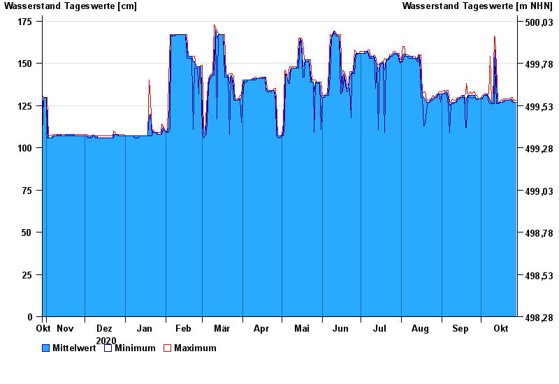
- Chart of year

Chart of year Förmitz Speicherabfluss / Förmitz
Waterlevel from 29.10.2020 to 28.10.2021
- 19.03.2009 Wasserstand: 212 cm
- 21.08.1970 Wasserstand: 205 cm
- 11.11.2015 Wasserstand: 190 cm
- 25.02.2002 Wasserstand: 190 cm
- 03.03.1986 Wasserstand: 187 cm
| Date | Mean value [cm] | Maximum [cm] | Minimum [cm] |
|---|---|---|---|
| 28.10.2021 | 127 | 128 | 127 |
| 27.10.2021 | 127 | 128 | 127 |
| 26.10.2021 | 127 | 128 | 127 |
| 25.10.2021 | 128 | 130 | 127 |
| 24.10.2021 | 129 | 130 | 128 |
| 23.10.2021 | 128 | 129 | 128 |
| 22.10.2021 | 128 | 129 | 128 |
© Bayerisches Landesamt für Umwelt 2024