
- Start >
- Rivers >
- Waterlevel >
- Oberer Main - Elbe >
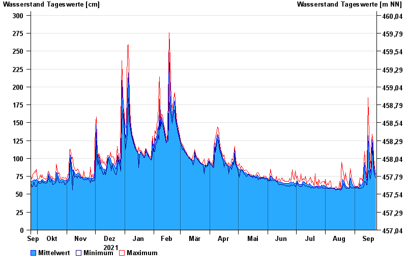
- Erbendorf >
- Chart of year

Chart of year Erbendorf / Fichtelnaab
Waterlevel from 24.09.2021 to 23.09.2022
- 30.12.1986 Wasserstand: 344 cm
- 28.05.2006 Wasserstand: 338 cm
- 10.03.1981 Wasserstand: 334 cm
- 26.01.1995 Wasserstand: 332 cm
- 28.01.2002 Wasserstand: 329 cm
| Date | Mean value [cm] | Maximum [cm] | Minimum [cm] |
|---|---|---|---|
| 23.09.2022 | 77 | 79 | 73 |
| 22.09.2022 | 81 | 87 | 76 |
| 21.09.2022 | 92 | 100 | 83 |
| 20.09.2022 | 109 | 122 | 100 |
| 19.09.2022 | 126 | 134 | 115 |
| 18.09.2022 | 86 | 115 | 79 |
| 17.09.2022 | 80 | 86 | 71 |
© Bayerisches Landesamt für Umwelt 2024