
- Start >
- Rivers >
- Waterlevel >
- Oberer Main - Elbe >
- Dobrigau >
- Chart of month

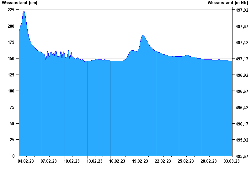
Chart of month Dobrigau / Wondreb
Waterlevel from 04.02.2023 to 03.03.2023
- Hochwassergefahrenfläche HQhäufig 270 cm
- Hochwassergefahrenfläche HQ100 290 cm
| Date | Waterlevel [cm] |
|---|---|
| 03.03.2023 23:45 | 146 |
| 03.03.2023 23:30 | 146 |
| 03.03.2023 23:15 | 146 |
| 03.03.2023 23:00 | 146 |
| 03.03.2023 22:45 | 146 |
| 03.03.2023 22:30 | 146 |
| 03.03.2023 22:15 | 146 |
© Bayerisches Landesamt für Umwelt 2024