
- Start >
- Rivers >
- Waterlevel >
- Oberer Main - Elbe >
- Behringersmühle >
- Chart of year

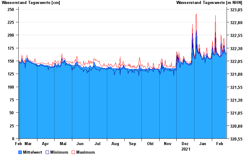
Chart of year Behringersmühle / Wiesent
Waterlevel from 27.02.2021 to 26.02.2022
- 13.01.2011 Wasserstand: 290 cm
- 03.06.2013 Wasserstand: 279 cm
- 27.08.2010 Wasserstand: 278 cm
- 23.12.2012 Wasserstand: 276 cm
- 28.05.2006 Wasserstand: 273 cm
| Date | Mean value [cm] | Maximum [cm] | Minimum [cm] |
|---|---|---|---|
| 26.02.2022 | 164 | 166 | 162 |
| 25.02.2022 | 166 | 168 | 164 |
| 24.02.2022 | 167 | 169 | 165 |
| 23.02.2022 | 172 | 176 | 168 |
| 22.02.2022 | 181 | 194 | 171 |
| 21.02.2022 | 179 | 190 | 166 |
| 20.02.2022 | 164 | 166 | 163 |
© Bayerisches Landesamt für Umwelt 2024