
- Start >
- Rivers >
- Waterlevel >
- Oberer Main - Elbe >
- Bayreuth >
- Chart of year

Chart of year Bayreuth / Roter Main
Waterlevel from 22.01.2023 to 21.01.2024
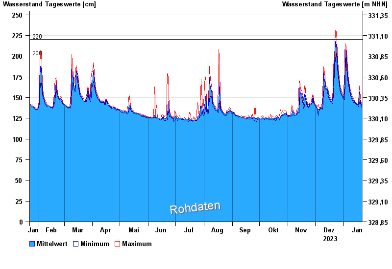
- 200 cm: Bayreuth: Ausuferung bei den Auwiesen unterhalb des Pegels.
- 220 cm: Verbindungsstraße Heinersreuth - Cottenbach: Überflutung im Maintal.
| Date | Mean value [cm] | Maximum [cm] | Minimum [cm] |
|---|---|---|---|
| 21.01.2024 | 140 | 142 | 138 |
| 20.01.2024 | 143 | 145 | 141 |
| 19.01.2024 | 149 | 157 | 145 |
| 18.01.2024 | 157 | 164 | 144 |
| 17.01.2024 | 141 | 144 | 139 |
| 16.01.2024 | 142 | 142 | 141 |
| 15.01.2024 | 143 | 143 | 142 |
© Bayerisches Landesamt für Umwelt 2024